
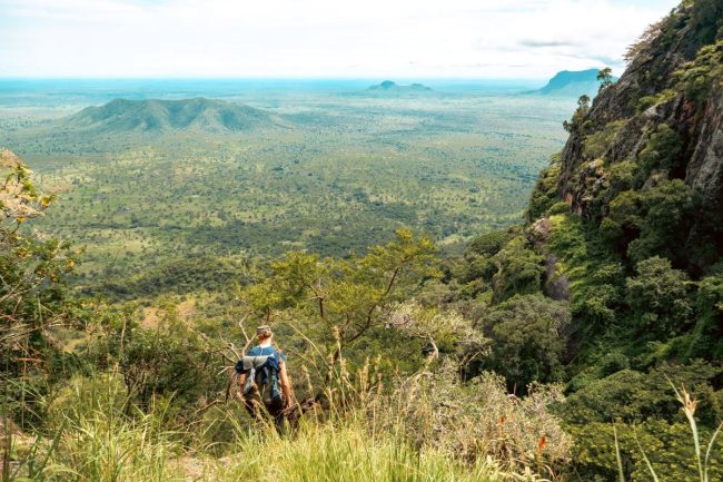
One of Uganda’s strengths as a tourism destination is that it is diverse, with every adventure available in the country. Adventure enthusiasts and nature lovers, Uganda offers the best hiking experience ever in the whole region and beyond. Uganda does not just talk the talk but walks the talk in offering the best hiking destinations in the land.
Whether it is offering a highly intense and challenging hiking experience or a moderate and adventurous experience, this country has got you covered. In addition, the best hiking destinations in Uganda are all scattered across the multiple directions of the country. This offers a chance to explore the different terrains and environments across the country.
It is worth mentioning that hiking is a bit different from trekking or even nature walks. Hiking usually takes place in steep terrain like mountains, and its main purpose is for sightseeing or recreational purposes. Trekking, on the other hand, focuses on attractions like gorillas and chimpanzees, and it sometimes takes longer. Nature walks are simpler, taking place on relatively flat terrain through different vegetation zones. Our main focus in this article is hiking and the best places or destinations for hiking across the country.
What are the best hiking destinations in Uganda?
For hiking adventures, one could not have asked for a better destination for hiking than Uganda. This diverse nation offers the best hiking destinations for all types of hikes, and these destinations include the following.
Mountain Rwenzori
In the heart of Kasese district on the border with the Democratic Republic of Congo, sits Mountain Rwenzori. This enormous mountain is situated in the Mountain Rwenzori National Park. It is also known as the Mountains of the Moon, a statement translated from the local name Ruwenzori. This meant that this mountain was from the clouds or the moon since its peaks cannot be seen from the base. Hiking duration to its peak takes an average of 7-12 days, depending on the fitness of the visitor. The Mountains of the Moon are also believed by many scholars to be the source of the River Nile, the world’s longest river. This is simply because many rivers originate from this mountain, and these rivers feed the Nile.
This mountain, as a popular hiking destination, offers an unmatched hiking experience. This mountain displays some of the unique species, both flora and fauna. It is the tallest mountain in the country and has some of the tallest ranges in the region. A hiking experience in the different trails of Mount Rwenzori offers an extraordinary experience where each zone feels like you are in a new country. This mountain has been a recognized UNESCO World Heritage Site since 1994, since it is among the tallest mountains in the region. The tallest peak of this mountain is called Margherita Peak, standing at 5,109 meters above sea level on Mount Stanley. This peak is snow-capped year-round.
Mountain Elgon
At the eastern border with Kenya, an ancient extinct volcanic mountain emerges from the ruins. This is Mountain Elgon, a fortress of nature standing over the calm borders shared by Uganda and Kenya. This mountain is located in the Mbale district, a popular land of the Bamasaba people. It is famous as a hiking destination based in the eastern region and the ideal hiking place for adventure enthusiasts.
The Elgon Mountain offers splendid adventurous activities to couple with a hike to its peak, like the exploration of the Sipi Falls. It is believed that Mount Elgon was once the tallest mountain in the country and the region about a thousand years ago. However, the forces of nature, like erosion over a long period of time, have worked on it, shaping its peak relatively. This is why Mount Elgon has one of the largest mountain calderas in the world. Wagagai, the tallest peak of Mountain Elgon, stands at 4,321 meters above sea level.
Mount Morungole
Hiking adventure takes you on an exploration journey to the Karamoja sub-region to Mount Morungole. Mount Morongule, as some may call it, is a free-standing dormant volcanic mountain. This mountain forms a natural boundary in the southern region of Kidepo Valley National Park. Hiking this mountain is a good choice, as it does not require any special mountaineering gear to hike. It is also relatively short, standing at only 2,749 meters above sea level.
Mount Murungole, as a hiking destination, also harbors the Ik people. These are some of the rare cultural or tribes of people situated on the slopes of this mountain. These Ik people are some of the few tribes in the country that have jealously protected their culture. This is because they are highly isolated and rarely encountered or visited. They neighbour their close cousins, the Karamojong people.
The hiking experience of Mount Murungole requires one to present a hiking permit issued by the Uganda Wildlife Authority. This hiking permit can be obtained by the client through a reputable tour company like Monteero Safaris. Experience a moderate hiking experience with a blend of cultural experiences as you hike Mount Murungole.
Bwindi Impenetrable National Park
The steep terrain of Bwindi Impenetrable National Park also makes it a best hiking destination. The mountainous nature of Bwindi presents hiking opportunities to visitors eyeing an adventure experience. Hiking in Bwindi is quite difficult and presents a challenge due to the steepness, and it is further complicated by the dense vegetation.
There are designated hiking trails that visitors use for an incredible hiking experience. Some of these trails include Mubwindi trail, River Ivy trail, and Munyaga River trails. These trails are designated and ease the hiking experience. Hiking in Bwindi also offers a chance to encounter some animals, such as primates, and also bird species.
Mgahinga Gorilla National Park
As part of the extension of the Virunga massif, Mgahinga Gorilla National Park is another ideal hiking destination in Uganda. At the forefront, Mgahinga hosts three volcanic mountains that form an extension of the Virunga Mountains that stretch from the Democratic Republic of Congo. Mgahinga is located in the southwestern region of Uganda at the border with Rwanda. Some of the Virunga Mountains in Mgahinga Gorilla National Park include the following.
- Mount Sabyinyo: Shared with Uganda, Rwanda, and the Democratic Republic of Congo, Mount Sabyinyo is the oldest volcanic mountain of the Virunga ranges. It is an extinct volcanic mountain standing at 3,669 meters and forms an intersection of three countries. Sabyinyo is a word from the local language that means the old man’s teeth, since this mountain has a rugged peak like the teeth of an old man.
- Mount Muhabura: Still in Mgahinga, Mount Muhabura is another of the best hiking destinations. Hiking to the top of this mountain takes about 6-10 hours since this mountain is the third-highest volcano of the Virunga massif. This mountain stands at an elevation of about 4,127 meters above sea level. Mount Muhavura, as some people call it, is a local name that means to guide.
- Mount Gahinga: Mgahinga Gorilla National Park actually gets its name from Mount Gahinga. This mountain is also part of the Virunga ranges, and it’s located between Mount Sabyinyo and Mount Muhabura. Gahinga is a local word from the Rufumbira dialect, which means a small pile of rocks. At an elevation of 3,473 meters above sea level, this mountain is the smallest among the three volcanic Virunga ranges in Mgahinga Gorilla National Park. It offers an incredible hiking experience like no other, since there are higher chances of encountering small primates.